
Manitowoc ZIP Coverage Check
Official City of Manitowoc addresses consistently use 54220, making it the verified standard delivery pattern in the local source set. Local materials also report 54221 as a Manitowoc post-office-box pattern, but the live USPS result needed to confirm its current type and full reach was not captured. A possible 54223 association appeared only in nonofficial mapping results. It must not be presented as a City-serving ZIP without a current USPS check.
| ZIP | Documented Area or Role | Postal Facility | Verification Note |
|---|---|---|---|
| 54220 | Standard City of Manitowoc delivery pattern in official city addresses | Manitowoc postal service; station name not captured | Confirm each exact address through USPS |
| 54221 | Reported Manitowoc mailing and P.O.-box pattern | Manitowoc P.O.-box service; station designation not captured | Type and full coverage need live USPS confirmation |
| 54223 | Possible broader or adjacent postal association only | No official station source located | Do not treat as a City ZIP without USPS proof |
This careful table reflects what the research can support. It does not invent neighborhoods, station names or boundary lines that were absent from the official results. A Manitowoc ZIP code directory should preserve those limits because ZIP assignments change and delivery geography is not a census of residents.
Verify Manitowoc ZIP Codes
The USPS ZIP Code Lookup offers three useful modes. “By Address” accepts a street, optional firm or apartment, city, required state and optional ZIP. “By City and State” checks the recognized postal ZIP or ZIPs for a locality. “Cities by ZIP” reverses the question and reports the city names recognized for a ZIP.
The official USPS source shown below is the right starting point for any uncertain Manitowoc ZIP code.
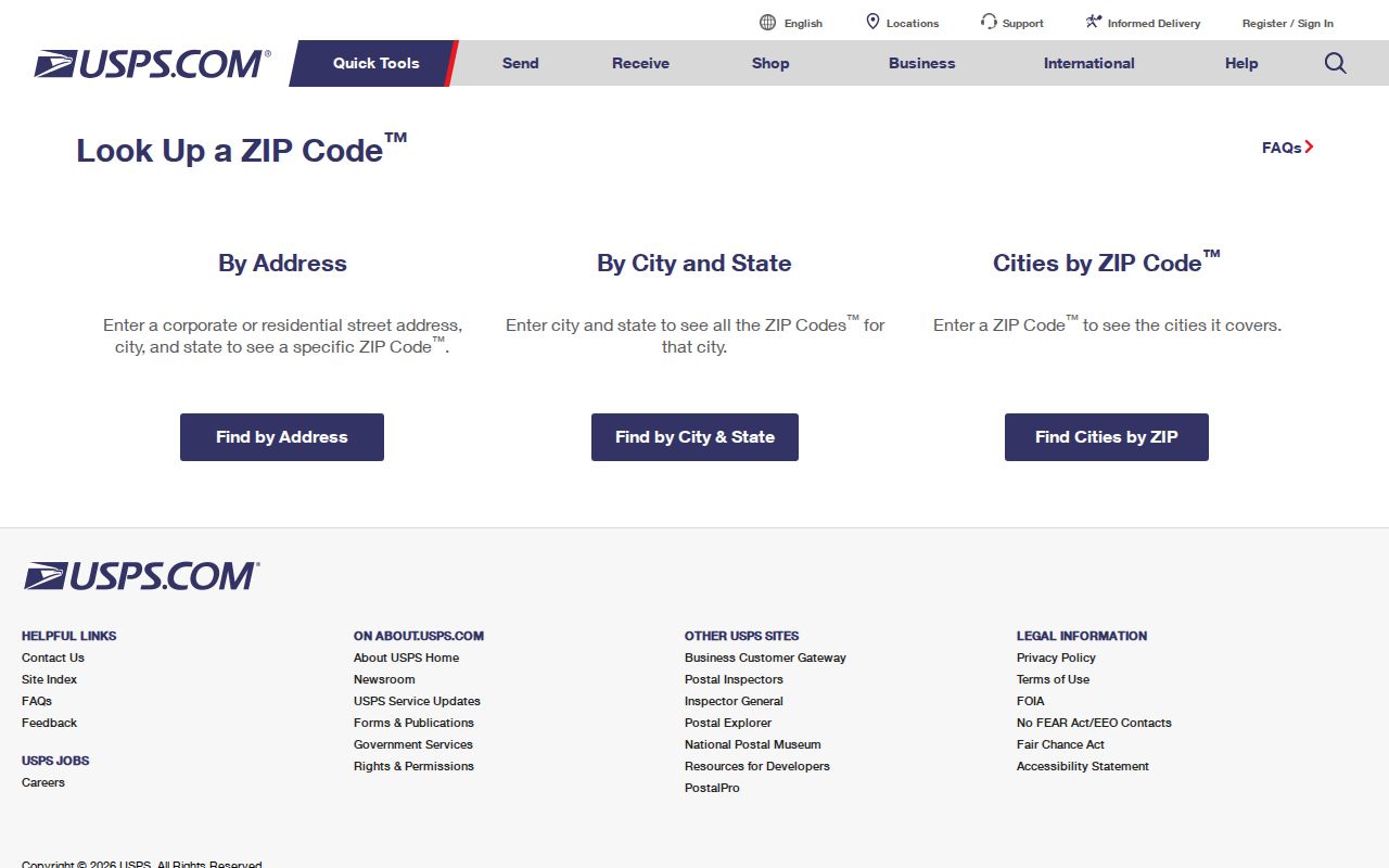
A valid result confirms mail formatting and service geography. It does not prove that a named person or firm occupies the address. Save the preferred city, state and ZIP shown by USPS, then compare the exact location with municipal and parcel records.
| USPS Mode | Required Search Key | Useful Result |
|---|---|---|
| By Address | Street, city and state | Formatted address and delivery ZIP |
| By City and State | City and state | Recognized postal ZIP choices |
| Cities by ZIP | ZIP | Preferred or accepted city names |
Narrow a Manitowoc ZIP Search
Local property tools are not ZIP-first. The City Ascent interface captured for Manitowoc has fields for municipality, parcel ID, street number, street name, mailing address, owner first and last name, and public-land-survey location. It did not expose a dedicated ZIP field. The GIS viewer works from parcels and map layers. USPS, by contrast, starts with delivery information.
- Confirm a known sample address in USPS “By Address.” Record the recognized city and ZIP.
- Check “By City and State,” then reverse the candidate in “Cities by ZIP.” Do not rely on a third-party ZIP list.
- Open the City or County GIS and decide whether the parcel lies inside Manitowoc's legal boundary.
- Search City Ascent by street or parcel when the property is in the city. Use County Ascent for the appropriate county parcel.
- Use the city alderperson map or MyVote for civic districts and polling context, because those lines are not ZIP lines.
Once the search reaches a named road, the Manitowoc street directory provides the street-level record chain. The ZIP step narrows geography; it cannot identify everyone at an address.
Note: A mailing address and a situs address can differ, so copy both labels exactly when moving from USPS to a tax record.
Manitowoc Records Are Not ZIP-First
The portal split matters. The City of Manitowoc Ascent portal supplies current city parcel information, while the county Treasurer states that City of Manitowoc and Two Rivers parcels appear in its current-owner search chiefly when delinquent tax balances exist. Searching the county site alone can therefore miss a current city owner.
City Ascent results can show parcel, owner, site address, privacy-expiration field and tax years. Mailing address is its own search field. An owner mailing address may be elsewhere and does not change the parcel's situs, meaning its physical site. Nor does either address prove that every household member lives there. This is why a ZIP code directory should guide the choice of portal without promising a ZIP-wide resident roll.
| Local Search Field | Accepted by City Ascent | What It Narrows |
|---|---|---|
| Municipality | Yes | Tax jurisdiction |
| Parcel ID | Yes | One assessed parcel |
| Street number and name | Yes | Situs location |
| Mailing address | Yes | Owner contact address |
| Owner first and last name | Yes | Tax-roll owner |
| ZIP | Not captured | Use USPS instead |
Map Manitowoc Beyond ZIP Lines
The Manitowoc maps and records hub leads to parcel data and geographic tools that are better suited to legal boundaries than a postal code is. The local GIS hub says data is updated monthly. Its map gallery includes tax parcels, zoning, aerial photos by year, wards, aldermanic districts, transit, streets and cemetery maps. Live tool controls were not fully captured, so use the viewer's available parcel and layer controls rather than expecting a named ZIP filter.
The official records-map source below illustrates the local route from delivery geography to parcel geography.
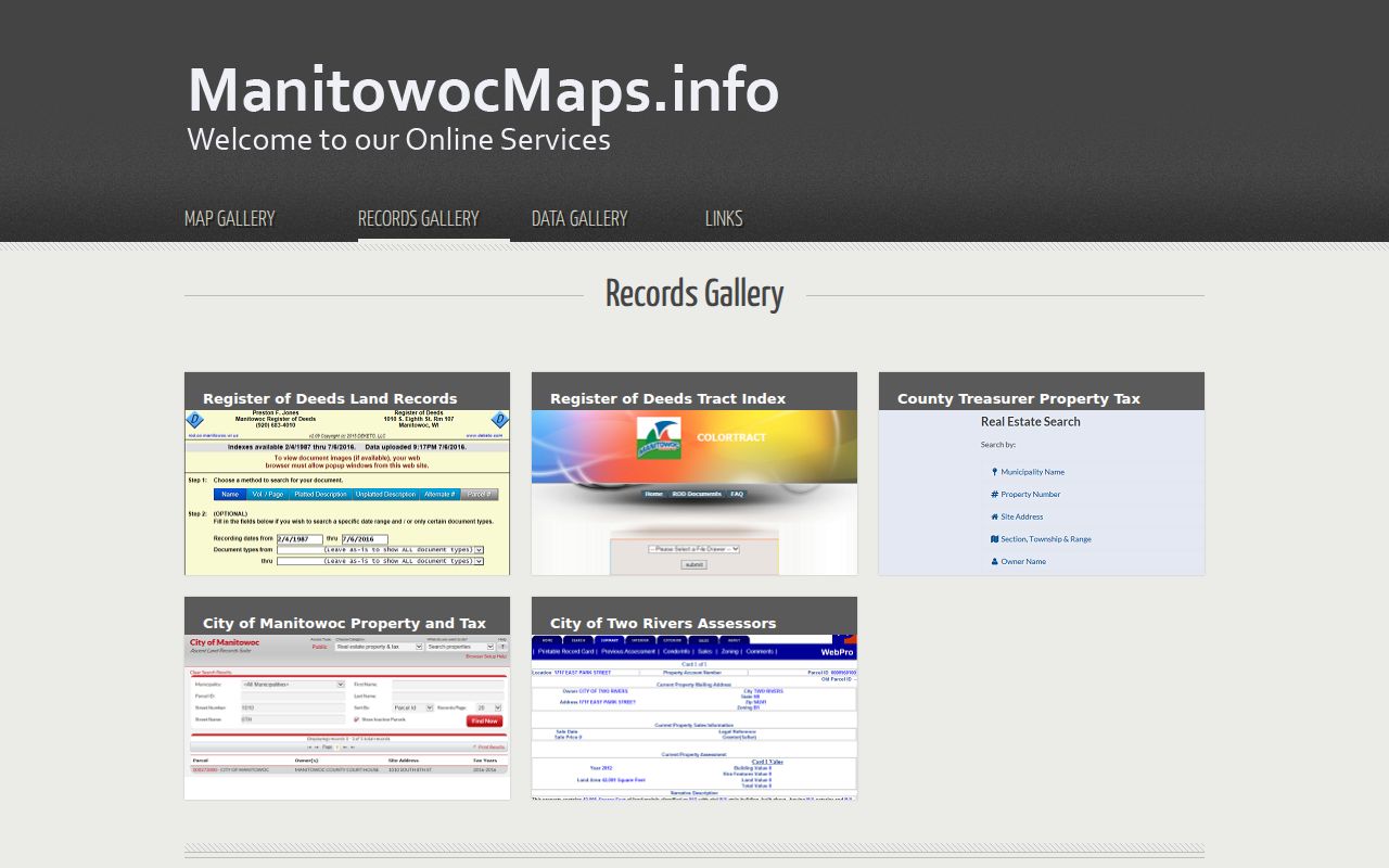
Clicking or locating a parcel can produce the parcel key needed for the assessor and deed systems. For edge addresses, compare the map boundary with the USPS result. A Manitowoc mailing city outside the corporation can be valid for mail while remaining outside City tax and service jurisdiction.
Manitowoc ZIPs and Civic Districts
A ZIP does not choose an alderperson, ward or polling place. Manitowoc's address-driven alderperson and polling map is the local civic cross-check. Enter the street address and use the map's district result. Wisconsin MyVote then handles a voter's own registration and polling details.
Voter-file access follows Wis. Stat. §6.36 and related rules. Public registration data may include a name, residence address, ward or district and participation dates, but protected birth data, identification numbers, confidential addresses, ballot choices and voting accommodations are excluded. A ZIP-wide voter extract is therefore neither a complete resident directory nor a map of all households. Use the lawful request route through election officials when a public list is needed.
Note: The district shown for a street address can change even when its USPS ZIP stays the same, because civic and postal lines serve different systems.
Historic Manitowoc Predates ZIP Codes
Old Manitowoc address research should not force modern ZIP codes onto records created before postal ZIPs existed. The City's original plat dates to 1851. Historical work can follow a lot, block and legal description through city directories, deeds and maps even when the present street number is a poor match. The 1883 Manitowoc Sanborn fire-insurance map set contains nine sheets, offering building footprints and street context from long before current postal geography.
The Manitowoc Public Library's digitized city and county directories run irregularly from 1868 through 1920, while Manitowoc County Historical Society holdings begin in 1864. Those directories may list people alphabetically or by street and can bridge an old address to a later parcel. Plats and public-land-survey descriptions handle rural or edge parcels where the mailing city does not match the municipality.
This history explains a key ZIP code directory limit: a current delivery label is useful for today's mail, not for tracing an nineteenth-century resident. For early property, the parcel's legal description is the more durable key.
Manitowoc ZIP and City Limits
Postal geography is built for routing mail. Municipal geography sets the City's legal reach, while the assessor determines which tax roll holds a parcel. These layers can disagree without an error. A county parcel may use “Manitowoc” in its mailing address yet lie beyond the city line. A post-office box can use a Manitowoc ZIP while revealing nothing about the physical site.
- ZIP code
- A five-digit USPS routing code for a delivery area, not a municipal boundary.
- ZIP+4
- The five-digit ZIP plus four digits that narrow a delivery segment.
- P.O.-box ZIP
- A code or pattern used for post-office boxes rather than street delivery.
- Unique ZIP
- A ZIP assigned to one high-volume organization; none was verified for Manitowoc research.
- Carrier route
- A group of delivery points served along one postal route.
- Situs address
- The physical location of a parcel, distinct from an owner's mailing address.
The safe test is exact and repeatable: USPS for delivery, GIS for the mapped parcel, Ascent for tax jurisdiction, and the city address map for wards or alder districts. Keep each result under its own label.
Boundary check. Never infer City residency from a Manitowoc mailing name alone. Confirm the parcel against the current municipal map.